
Hastings-Sunrise
The traffic calming map
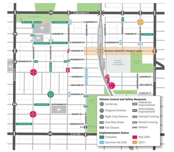
This is the City of Vancouver’s own map of the traffic calming measures in Hastings-Sunrise, between Renfrew Street, Boundary Road, East Hastings Street and East 1st Avenue. It shows the one-way streets, diverters, closures and cul-de-sacs residents now have to navigate to get home.
Reading the map: green items are complete, pink were scheduled for May 2026, blue for summer to fall 2026, and orange for 2027 or later. Tap or click the map to open it full size.
Does this match your street?
If the map doesn’t reflect what you’re living with, tell us.
Share your storyTraffic calming: read the evidence, and the data that’s still missing